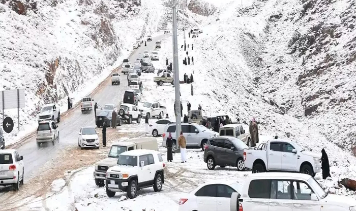
Recent catastrophic flooding in Spain has resulted in tragic loss of life and extensive damage, prompting the deployment of 10,000 troops for rescue and recovery efforts. More than 200 people have died as a result of these floods, with 205 confirmed fatalities in Valencia, two in Castilla-La Mancha, and one in Andalusia. The Chiva area of Valencia was particularly hard-hit, receiving an astonishing 491 liters of rain per square meter in just 8 hours—far exceeding the average of about 65 l/m² typically expected for the entire month of October.
The storms began spreading west on Wednesday night and continued into Thursday, creating deadly conditions across Andalusia and Castilla-La Mancha. As communities grapple with the aftermath, experts point to climate change and extreme weather patterns as critical factors in the severity of this disaster. The rapid onset of flooding, combined with unprecedented rainfall, highlights the urgent need for addressing climate-related vulnerabilities and improving infrastructure resilience to better protect lives and property in the face of such extreme weather events.
Key Takeaways
- DANA Phenomenon: The flooding was primarily caused by DANA (Isolated Depression at High Levels), leading to intense and localized rainfall.
- Rapid Onset: Heavy rains began on Tuesday evening, catching many residents off guard despite early alerts, resulting in dangerous conditions and stranded drivers.
- Increasing Global Flash Floods: Flash floods are becoming more frequent worldwide, with studies indicating a 10-30% increase in heavy rainfall events since the late 20th century.
- Climate Change Impact: Rising global temperatures contribute to more intense rainfall, with projections showing a potential 50% increase in extreme rainfall days by century’s end.
- Urbanization Risks: Increased urbanization has led to more impervious surfaces, causing quicker runoff and a doubling of flooding events in cities over the past 50 years.
How quickly the floods hit?

Heavy rain began affecting parts of southern Spain on Monday, with areas like Malaga experiencing consistent downpours for two days. However, in the hardest-hit region of Valencia, the rain didn’t start until around 7 PM on Tuesday.
By 8 PM, residents in Valencia received smartphone alerts advising them to stay indoors. Unfortunately, many were already caught in perilous situations, especially in the southern part of the city, where a major road had flooded, leaving drivers stranded in their vehicles.
This swift onset of flooding resulted in dangerous conditions, with water levels rising dramatically in rivers and urban areas, overwhelming emergency services and leaving little time for evacuation or preparation.
What caused the flash floods in Spain?
Heavy rain is not uncommon across the eastern part of Spain at this time of year. This disaster in Spain was caused by a meteorological phenomenon called DANA (Depresión Aislada en Niveles Altos (Isolated Depression at High Levels)). In Spain, DANA typically occurs when a low-pressure system forms at high altitudes, causing significant atmospheric instability. This instability can result in intense and concentrated rainfall, particularly in certain regions.
How DANA works?
- Formation: DANA forms when cold air at high altitudes interacts with warmer, moist air at lower levels. This temperature difference creates instability in the atmosphere, leading to the development of storms.
- Heavy Rainfall: As the unstable air rises, it cools and condenses, forming clouds and precipitation. The result can be heavy rainfall over a short period, often referred to as “cloudbursts.” This sudden deluge can overwhelm drainage systems, particularly in urban areas.
- Localized Impact: DANA events can produce localized flooding, meaning that while some areas may experience intense rain, others nearby might see little to no precipitation. This variability can make forecasting and preparation challenging.
Certainly! Here’s a more detailed overview of the increasing prevalence of flash floods, along with relevant data and studies:
Flash floods across the world have become more frequent

- Global Trends: Research indicates that extreme precipitation events, which can lead to flash floods, have been increasing in frequency and intensity globally. A study by the Intergovernmental Panel on Climate Change (IPCC) found that heavy rainfall events have increased in many regions by about 10-30% since the late 20th century.
- Data from the United States: According to the National Oceanic and Atmospheric Administration (NOAA), the U.S. has experienced a significant increase in heavy rainfall events. Data shows that the frequency of heavy precipitation days has increased by approximately 15% since 1950. The Federal Emergency Management Agency (FEMA) reports that flash floods are one of the most common and widespread hazards, causing about 50% of all flood-related fatalities.
- Impact of Climate Change: A study published in Nature Communications in 2020 highlighted that the intensity and duration of extreme rainfall events are projected to increase as global temperatures rise. The study noted that climate models predict an increase in the frequency of the heaviest rainfall events, with some regions experiencing up to a 50% increase in extreme rainfall days by the end of the century.
Flash floods case studies
- Europe: A 2021 report from the European Environment Agency noted that extreme weather events, including flash floods, have increased across Europe. For instance, central Europe experienced devastating floods in July 2021, with regions in Germany and Belgium reporting rainfall amounts that were two to three times higher than normal.
- India: The monsoon season has also seen an uptick in flash floods. In 2021, heavy rainfall led to flash floods in Maharashtra, causing significant loss of life and infrastructure damage. The Indian Meteorological Department noted that rainfall during the monsoon months has increased by about 30% in some areas over the last few decades.
Why flash floods are increasing?
1. Increased Intensity of Rainfall
According to the National Climate Assessment (NCA) in the United States, the intensity of heavy rainfall events has increased by about 20% since 1958. Warmer air can hold approximately 7% more moisture for every degree Celsius increase in temperature, as explained by the Clausius-Clapeyron relation. This enhanced moisture availability contributes to sudden, intense downpours that can overwhelm drainage systems, particularly in urban areas where infrastructure may not be equipped to handle such extremes.
2. Too much urbanization
Urbanization significantly increases the risk of flash flooding due to the prevalence of impervious surfaces. According to a study by the World Resources Institute, urban areas have seen a doubling of flooding events over the past 50 years, with cities like Los Angeles and New Orleans particularly affected. For instance, impervious surfaces prevent rainwater from being absorbed into the ground, resulting in quicker runoff. A report from Nature Climate Change highlights that urban areas can experience up to 50% more runoff than rural areas due to this lack of absorption. This leads to overwhelmed stormwater systems, contributing to flash flooding.
3. Changes in Weather Patterns
Shifts in global weather patterns due to climate change have made storms more frequent and intense. The IPCC Special Report on Climate Change and Land states that extreme weather events, including heavy rainfall, are becoming more common across the globe. Regions that previously experienced stable weather patterns are now facing increased variability. For example, the European Environment Agency reported a significant increase in extreme precipitation events in southern and central Europe, with some areas experiencing rainfall totals that were two to three times higher than historical averages during major flooding events.
4. Soil Saturation
Soil saturation plays a critical role in flash flood dynamics. When prolonged rainfall occurs, the ground becomes increasingly saturated and loses its ability to absorb additional moisture. Research from the University of Washington found that when soils are saturated, even a small amount of additional rain can lead to rapid runoff and increased flooding risk. In regions like the Midwest U.S., where soil saturation levels can reach 90% or more after extended rainfall, flash floods can occur with as little as 0.5 inches of additional rainfall. This phenomenon was notably observed during the 2019 Midwest floods, where areas received record rainfall during already saturated conditions.
5. Increased Awareness and Reporting
Advancements in technology, such as radar systems and satellite monitoring, have improved the ability to detect and report flash floods, leading to increased public awareness. According to the National Weather Service (NWS), the use of Doppler radar has enhanced the ability to forecast severe weather, allowing for more timely alerts and warnings. This capability has contributed to a rise in reported flash floods, as communities are now more aware of their risks. The NWS noted a marked increase in flash flood warnings issued over the past two decades, reflecting not only a rise in events but also improved detection and reporting mechanisms.
Investing in sustainable urban planning, improving drainage infrastructure, and enhancing forecasting capabilities will be essential to reduce the impact of flash floods in vulnerable regions.